‘Water Resources’ Category

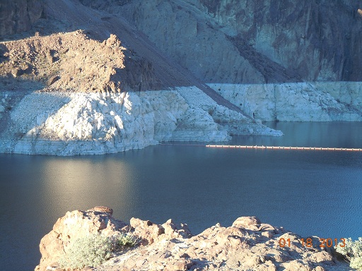
Lake Mead Waterline

Photo Credit: Jessie Benaglio

You can see the varying water line on the rock near the Hoover Dam. The original water line is where the water started for the formation of Lake Mead while the Hoover Dam was being built. The Colorado river had to be re-routed for the construction of the Hoover Dam, originally known as Boulder Dam because of its location near Boulder City. Other dams were built to hold the water in for Lake Mead, which is the largest man made lake in the United States. The water level has not been as high as the water line because of the droughts since 1953. The lake draws most of its water from the snow melt from Colorado, Wyoming, and the Utah Rocky Mountains.
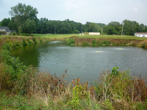
Aerated Lagoon – Wastewater Treatment

Photo Credit: Alyssa Jenkins

This is an aerated lagoon used for wastewater treatment. These ponds employ diffused aeration for mixing as well as adding oxygen to promote the degradation of organic compounds by microorganisms. Aerated biological treatment is typical of conventional wastewater treatment processes. These methods can achieve significant reduction in oxygen demanding compounds and nutrients present in the water before discharge back into the environment.

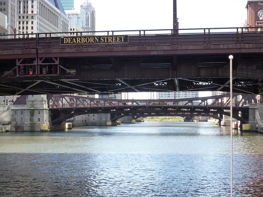
Parallel Draw Bridges, Chicago, IL

Photo Credit: Kathryn Kubicek

Pictured above are five draw bridges, located in downtown Chicago, spanning parallel across the Chicago river. Draw bridges are very important because they allow vessels to pass that would not be able to pass through a water way with a fixed bridge. Along this section of the Chicago river there are approximately two dozen draw and bascule bridges to allow the busy city street traffic and river traffic to coexist.

Olympus Dam, Estes Park, Colorado – Flood Control, Power Generation

Photo Credit: Alex Mead

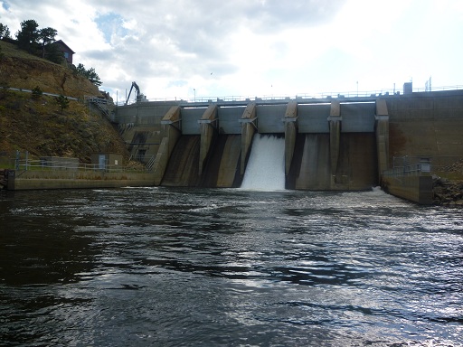
Seen here is the Olympus Dam in Estes Park, Colorado near Rocky Mountain National Park. The dam is 70 feet tall and created Estes Lake, 185 acres in size, after its completion. Construction started in the summer of 1947 and the dam is used today mainly for hydroelectric component to generate electricity. This dam uses sluice gates to regulate the height of the water behind it, and they can been seen at the top of the dam. Currently, the center gate of five is the only one open, but during the spring melt the dam can drain near full capacity to keep the water behind it at a safe level.

Broad Crested Weir

Photo Credit: Kathryn Kubicek

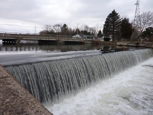
Seen here is a broad crested weir in Albion, Michigan. Broad crested weirs serve many purposes including monitoring flow, generating head for power generation, or simply deepening the water way behind themselves to make navigation possible for boats. This weir is of medium size and is currently in an average flow capacity state. During flooding this small drop will turn into a raging torrent that would drown even the strongest swimmers.

Manhole Cover Repair

Photo Credit: Jessie Benaglio

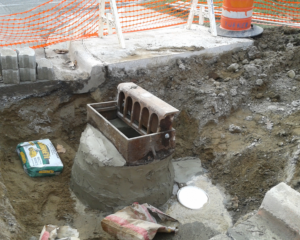
Shown here is the repair of the top part of a manhole. This structure is a catch basin, as indicated by the type of cover. This cover is designed to be placed in line with a curb in a roadway. The fresh concrete that is supporting the cover in this photo could be called a riser or corbel. Usually, the riser is above the corbel, which is a cone shaped section which flares down into the structure. Since this is a repair, the riser and corbel are basically 2-in-1. The reason this catch basin was repaired was the settlement of the roadway over time which caused the drainage to become unlevel.

Sluice Gate

Photo Credit: Karl Jansen

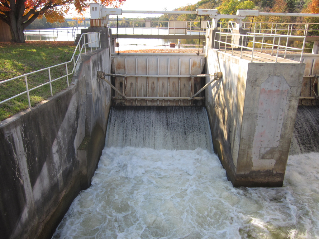
This is a vertical rising sluice gate, which means that a piece of machinery is used to adjust the height of the gate. By adjusting this height, the sluice gate is able to control the water. In general, sluice gates are used to control the level and flow rate of water in a river. When the gate is fully lowered, water could spill over the top of the gate which has the same effect as a weir. Sluice gates are a powerful tool used by engineers to control water in a river, which is especially critical during a time of flooding.

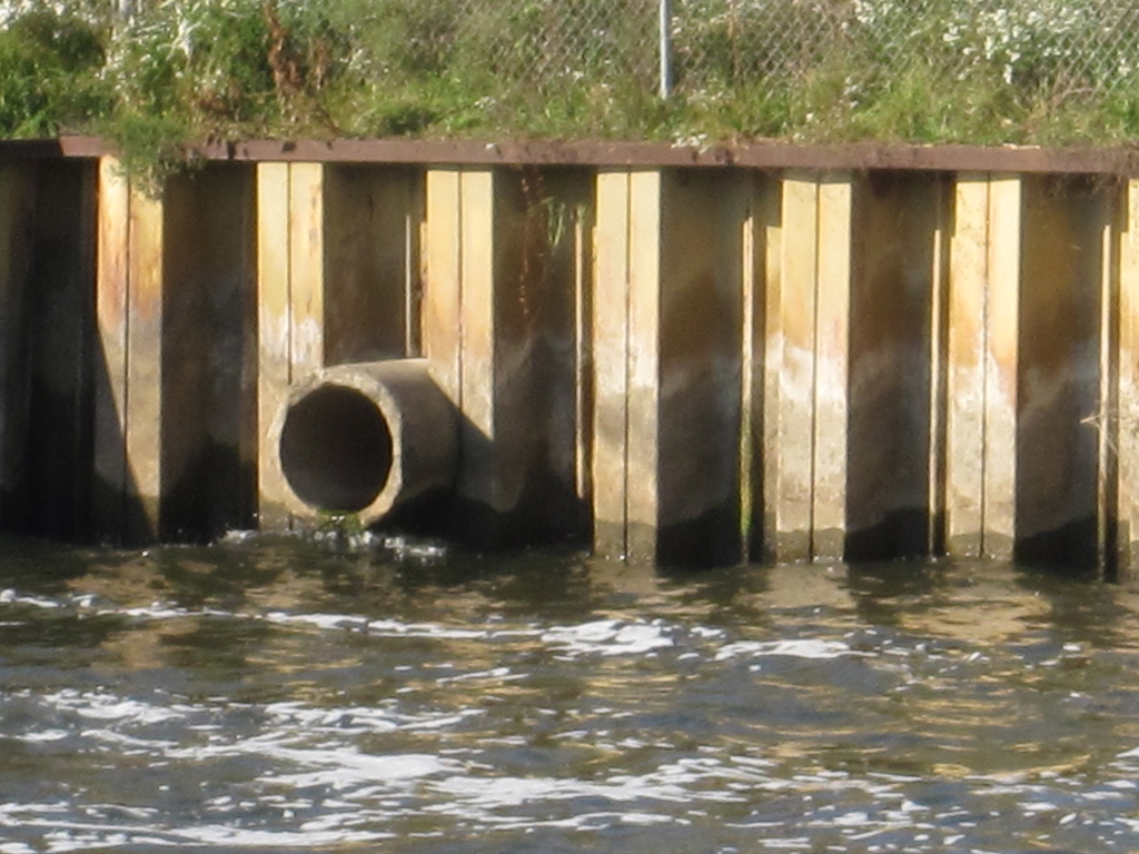
Storm Drain Outlet

Photo Credit: Karl Jansen

This is the outlet of a storm sewer system. These outlets provide a key link from the underground storm water systems found under most roads in urban areas, and the natural waterways of the watershed. Though most are hidden within brush or placed less visible places, this one is easily visible in the retaining wall near a dam.

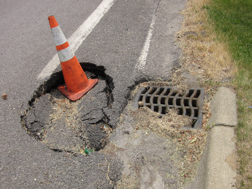
Sinkhole from Sewer Failure

Photo Credit: Karl Jansen

This is a special kind of sinkhole probably caused by the failure of a storm sewer system connection. Sinkholes like this one form when and where a sewer pipe fails, allowing rainwater to wash earth material into the pipe and down the system. When the earth is washed away, the above material collapses down causing a hole to form. Due to the close proximity of this sinkhole to a catch basin, this sink hole was probably caused by a failure of the connection of the sewer pipe to the structure.